©2021 Reporters Post24. All Rights Reserved.
Ukraine War and the Indo-Pakistan “Op Sindoor” have demonstrated an environment of “Aerial Denial”. This has occurred due to ground-based mobile air defense systems with considerable long-range engagement capabilities and very long-range air-to-air missiles (AAMs) with high no-escape zones.
This has meant preventing the adversary aircraft not only from crossing into their territory, but also from maintaining a greater distance within their territory, lest they be shot down.
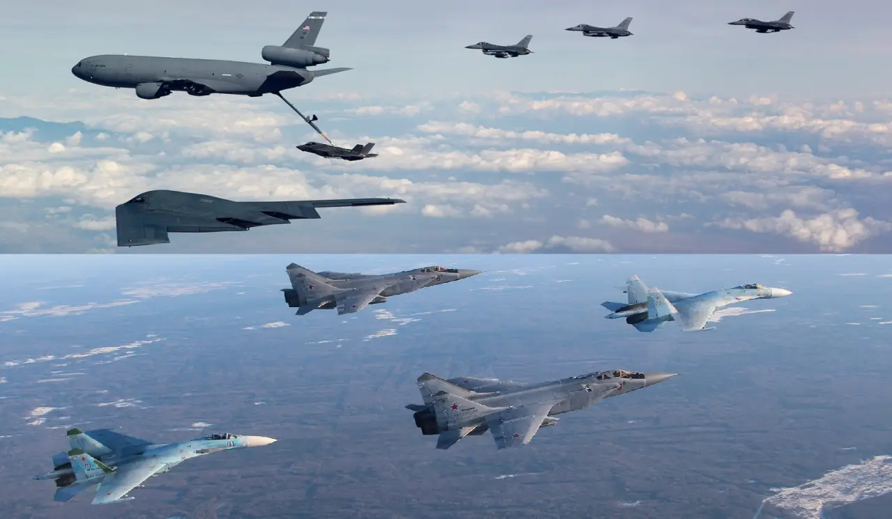
The most affected in this regard are the High Value Air Assets (HVAA), such as Flight Refuelling Aircraft (FRA) and airborne early warning and control (AEW&C) aircraft. These have high radar cross-sections, operate at subsonic speeds, and thus are easy targets at longer ranges.
Surface-to-Air Missiles (SAM) of the Russian S-500 class have operational ranges of nearly 600 kilometres. Similarly, the Chinese PL-17 (or PL-20) is an active radar-guided beyond-visual-range (BVR) AAM with a claimed range of more than 400 km against an HVAA target.
Meanwhile, satellite-based surveillance and control capabilities are increasing. Major space-faring nations have established satellite constellations to provide continuous coverage of their areas of interest, enabling earth observation, electronic and signals intelligence, early warning, space situational awareness, secure voice and data communications, and command and control.
Satellite data is being integrated with other technologies, such as AI and big data analytics, to enhance decision-making and response times. It is now time to examine this operational transition.
AEW&C Capabilities
The AEW&C systems provide a crucial advantage in air warfare by offering early warning, surveillance, command, and control capabilities. These systems, typically based on modified aircraft equipped with advanced radar and sensors, extend radar coverage beyond terrestrial limitations and enable effective coordination of air defences and battlefield management.
AEW&C systems detect airborne and surface targets at long ranges, providing critical time for defensive actions and offensive planning. For surveillance, they monitor vast areas, including airspace and sea, and can track both air and ground targets.
AEW&C platforms serve as airborne command centers, directing friendly aircraft, coordinating air defenses, and managing the battlefield. AEW&C systems integrate data from various sources, including onboard sensors, other aircraft, and ground stations, to create a comprehensive picture of the operational environment and enhanced situational awareness.
AEW&C systems are designed to operate as part of a larger network, sharing information with other military assets and command centres in real-time as part of net-centric warfare.
AEW&C provides flexibility and mobility, can be deployed rapidly, and operates in diverse environments, offering a mobile alternative to ground-based radar systems.
AEW&C systems are continually upgraded with new technologies, including advanced radar, improved communication systems, and enhanced data processing capabilities, to maintain their effectiveness.
Major Current AEW&C Systems
Boeing’s E-3 Sentry has a rotating radome that incorporates Westinghouse (now Northrop Grumman) radar. It is mounted on either the Boeing 707 or, more recently, the Boeing 767, the latter only being used by the Japan Air Self-Defence Force (JASDF).
The pulse-Doppler AN/APY-2 radar, installed on the E-767 and later E-3 models, has a range of more than 400 km for low-flying targets at its operating altitude.
The pulse (BTH) radar has a range of approximately 650 km for aircraft flying at medium to high altitudes. Introduced in 1977, 68 were built. These are currently operated by the United States Air Force (USAF), NATO, France, Chile, the Royal Saudi Air Force, and the JASDF.
The Grumman E-2 Hawkeye entered service in 1965 and was specially designed as a carrier-capable tactical airborne early warning (AEW) aircraft. With service entry in 1964, 313 were built. In addition to purchases by the US Navy, the E-2 Hawkeye has been sold to the armed forces of Egypt, France, Israel, Japan, Singapore, and Taiwan.
The Hawkeye 2000 version can track over 2,000 targets simultaneously to a range greater than 640 km.
The Russian Aerospace Forces are currently using approximately 3-5 Beriev A-50 and A-50U “Shmel” in the AEW role. The “Mainstay” is based on the Ilyushin Il-76 airframe, with a large non-rotating disk radome on the rear fuselage.
The A-50 will eventually be replaced by the Beriev A-100, which features an AESA array in the radome and is based on the updated Il-476. Inducted into service in 1985, 42 were built.
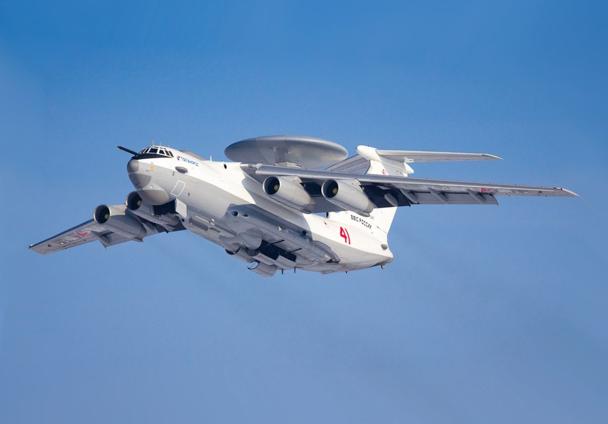
The Russian “Vega-M” radar can track up to 150 targets simultaneously within 230 kilometres. Large targets, such as surface ships, can be tracked at a distance of 400 kilometers.
The Indian Air Force’s (IAF) Phalcon AEW&C, inducted in 2009, utilizes the Israeli EL/W-2090 radar system. This radar provides 360-degree coverage and a detection range of 400 to 500 kilometres.
The Shaanxi KJ-2000 is a Chinese second-generation AEW&C aircraft built on a modified Russian Ilyushin Il-76 airframe, utilizing domestically designed avionics and a fixed radome featuring three active electronically scanned array (AESA) radars, each covering a 120-degree sector.
The maximum aerial detection range is 470 km. Five are operated by China. The new Chinese KJ-3000 AEW&C system, based on the four-jet Y-20 cargo plane, is designed to detect stealth aircraft and features long-range tracking capabilities. It is still under testing.
Three Indian DRDO “Netra Mk1” AEW&C have been in operation since 2015. It features an advanced Indian AESA radar system, fitted to the Brazilian Embraer EMB-145 airframe.
Netra covers around 250 km and gives a 240-degree coverage of airspace. The EMB-145 has air-to-air refueling capability, allowing for longer surveillance times. Six upgraded variants called Netra Mk1A are planned. Another six based on the Airbus A321 platform are also planned.
Australia, South Korea, and Turkey operate the Boeing 737 (or Boeing E-7 Wedgetail) AEW&C aircraft. It has a fixed AESA radar antenna with a maximum range of over 600 km in look-up mode.
A Saab platform with the Erieye ER radar, GlobalEye offers unique operational surveillance and identification capabilities. Pakistan operates nine Saab 2000 AEW&C. Brazil and a few other countries operate the Embraer E-99-based AEW.
Long Range Aerial Missiles
Long-range air-to-air missiles (LRAAMs) enable fighter aircraft to engage and neutralize enemy aircraft and other HVAAs from very far ranges. These missiles represent a significant leap in aerial combat capabilities, transforming doctrines, tactics, and procurement strategies.
LRAAMs primarily rely on radar guidance, specifically active radar homing (ARH), where the missile carries its own radar system for final target detection and tracking. This enables a “fire-and-forget” capability, freeing the launching aircraft to engage other targets or manoeuvre.
LRAAMs are being developed with advanced features, including cutting-edge propulsion systems, sophisticated radar seekers, and networked communication capabilities. China’s PL-15 is designed to target fighters, AWACS, and tankers at ranges of 200-300 km (145 km for the export variant, PL-15E). It features an AESA radar seeker, a dual-pulse solid rocket motor, and a two-way data link.
Russia’s Novator KS-172, with a speed of Mach 3.3, is designed to intercept high-value targets at ranges exceeding 400 kilometers. This missile (also known as K-100 or R-172) uses a tandem solid-fuel rocket booster and active radar guidance.
The Russian Vympel R-37M has a jettisonable rocket booster that increases the range to “300–400 km”. The export version of the R-37M, designated RVV-BD, has a range of 200 km and a maximum altitude of 25 kilometres.
European Meteor missile, operational since 2016, features throttleable ramjet propulsion for sustained power and an enhanced “No Escape Zone” of 60 km. It boasts a maximum speed above Mach 4 and a maximum range of 150-200 km.
USA’s AIM-260 JATM is under initial production. The Joint Advanced Tactical Missile aims to replace the AIM-120D AMRAAM (130–160 km), offering a range exceeding 200 km and compatibility with stealth fighters like the F-22 and F-35.
India’s Astra Mk1 is operational and utilizes a solid-propellant rocket, with a maximum range of 110 km. The Astra Mk2, equipped with a dual-thrust pulsed rocket motor, has a range of 160 km and is currently in a limited series production stage. The Astra Mk3 is currently in the trial stage and utilizes a Solid Fuel Ducted Ramjet, boasting a range of 350 km.
LRAAM Tactical Appreciation
The rise of LRAAMs is profoundly impacting air combat. Very long-range standoff engagements are becoming the norm. Pilots will increasingly rely on networked sensor information rather than visual cues for targeting.
Robust and secure communication links are critical for data sharing and mid-course guidance updates. LRAAMs are optimized for neutralizing assets like AWACS and tankers, crippling an adversary’s ability to coordinate operations. Collaborative Combat Aircraft (CCA) and “loyal wingmen” can act as missile carriers and sensor nodes, extending the reach of manned fighters.
LRAAMs have challenges. LRAAMs can be expensive to develop, procure, and operate. Integrating these complex systems onto existing and future platforms requires extensive testing and modifications. Maintaining missile effectiveness in contested electromagnetic environments is crucial. Reliable IFF technology at extended ranges is vital to prevent fratricide.
Future developments are likely to focus on integrating AI to enhance target recognition, decision-making, and trajectory optimization. Hypersonic and directed energy weapons (DEW) technologies could further extend engagement ranges and offer new defensive capabilities.
Space-based satellites could provide long-range detection, tracking, and guidance for missiles. As part of the multi-domain operations (MDO), LRAAMs may become capable of engaging both air and surface targets, increasing their versatility.
The race for extended reach in the skies is ongoing, driven by the need to maintain air superiority and adapt to evolving threats. LRAAMs will undoubtedly play a central role in shaping the future of aerial combat.
Long Range SAMs
The long-range surface-to-air missiles (LRSAM) are designed to intercept and destroy aerial threats at extended distances, often hundreds of kilometres away. These systems are crucial for defending against aircraft, cruise missiles, ballistic missiles, and other airborne threats.
They are part of the multi-layered air defence systems. LRSAMs often incorporate advanced technologies, such as active radar homing, dual-pulse rocket motors, and sophisticated guidance systems.
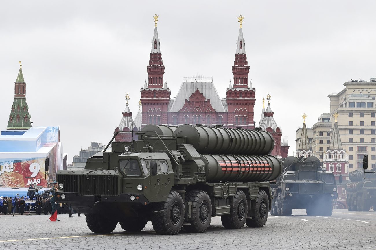
The Russian S-400 is considered one of the most advanced LRSAM systems that can intercept targets at ranges up to 400 km. An even more advanced system, the S-500 is designed to intercept hypersonic threats and targets at even more very long ranges.
China’s long-range SAM system, the HQ-9, is effective against a variety of aerial threats and is deployed by several countries besides China. The HQ-9 has a range of 120 km, and HQ-9B has a range of 300 km.
The Barak 8/MX (Israel/India), jointly developed by Israel Aerospace Industries and DRDO. The Barak 8 is a naval and land-based system with a range of up to 150 km.
Project Kusha is an Indian program to develop a mobile LRSAM. The project includes three interceptor missile variants with ranges of 150 km, 250 km, and 350 km, and is expected to be inducted into the Indian armed forces between 2028 and 2029.
The SM-6 (Standard Missile 6), also known as RIM-174 Standard ERAM, is a multi-mission missile developed by the U.S. Navy for extended-range anti-air warfare (ER-AAW). It is capable of intercepting a wide range of threats, including hypersonic, aircraft, cruise missiles, and ballistic missiles, and can also be used for anti-ship strikes.
It has a range of around 460 km, and around 500 km against surface targets. Terminal High Altitude Area Defence (THAAD) (200 km) and MIM-104 Patriot (160 km) are other systems.
Developed by Israel and the U.S., David’s Sling fills the gap between Iron Dome and long-range Arrow systems. It defends against medium- to long-range threats with a range of 70–300 km. Arrow 3 is designed to intercept ballistic missiles outside the Earth’s atmosphere with a maximum range of 2,400 km.
LRSAMs feature advanced guidance systems with sophisticated active radar homing and two-way data links, enabling them to track, identify, and guide missiles with precision towards their targets.
Some LRSAM systems, like the S-400 and Project Kusha, are also designed to intercept and destroy ballistic missiles. Modern LRSAMs can integrate with broader air defence networks, allowing for coordinated attacks and enhanced situational awareness.
Advanced systems are capable of simultaneously engaging multiple targets, making them effective against saturation attacks. LRSAMs are often designed for mobility, mounted on vehicles or deployable platforms, to allow for rapid relocation and adaptability to changing tactical situations.
Satellite-Based Surveillance and Control
Satellite-based surveillance and control involve using satellites to monitor and manage various activities on Earth and in space. Surveillance capabilities require satellites equipped with cameras and other electro-optical and radar sensors that can capture high-resolution images, providing valuable strategic and tactical data on entire adversary territories, as well as tactical battle monitoring and management.
Satellites can intercept electronic signals and communications, providing insights into potential threats and activities. Satellites can detect missile launches and nuclear activity, providing crucial early warning capabilities. They help create Space Situational Awareness (SSA) and Space Domain Awareness (SDA).
Tracking, telemetry, and control (TT&C) systems enable two-way communication, allowing ground stations to monitor and control a satellite’s propulsion, thermal, and other systems. Modern satellite systems are incorporating artificial intelligence (AI) to enable satellites to communicate and collaborate with each other in orbit, enhancing geo-intelligence and response capabilities.
The United States utilizes a robust space-based surveillance and control system. The US military relies on a diverse array of dedicated satellites for various purposes, including communication, intelligence, surveillance, reconnaissance, missile warning, and navigation and targeting.
The US Air Force Satellite Control Network (AFSCN) controls and manages its military satellites. Space Tracking and Surveillance System (STSS) tracks ballistic missiles and other objects in space. The Space-Based Infrared System (SBIRS) is a satellite system designed for missile warning, missile defence, and technical intelligence.
The Next-Generation Overhead Persistent Infrared satellites are designed to succeed SBIRS and provide enhanced capabilities for missile detection and surveillance. The U.S. Space Command and the U.S. Space Force are responsible for planning, executing, and integrating military space power.
Military Satellite Surveillance Capabilities
The United States operates nearly 250 military satellites, followed by China (160), Russia (110), and India, with around 10.
China’s satellite surveillance revisit time over India varies depending on the satellite’s orbit and capabilities. Satellites in Low Earth Orbit (LEO) revisit a specific location in minutes to hours, while those in Geosynchronous Orbit (GEO) offer persistent, continuous surveillance of the same area. China’s satellite constellation, including the Yaogan series, offers a diverse range of surveillance capabilities, encompassing electro-optical, radar, and electronic intelligence.
The Space-Based Surveillance-III (SBS-III) Program is India’s ambitious Rs 27,000 crore ($3.2 billion) program, which involves building 52 surveillance satellites for comprehensive Earth observation and border monitoring by 2029. ISRO will handle the design and launch of the first 21 satellites, while private companies will develop and launch the remaining 31.
The Defence Space Agency (DSA) will manage the operational command of the satellite constellation. It aims to gradually reduce India’s reliance on satellite imagery from foreign sources. It will harness on-board artificial intelligence (AI) to autonomously process imaging data, identify potential threats, and direct closer monitoring as needed.
USA, Russia, and China already have global satellite navigation systems. India is still struggling to operationalize its NavIC. GPS can be easily denied in any region.
Stealthy AEW&C
AEW&C’s primary mission requires beaming megawatts of radar power all over the battlefield. It is thus impossible to make stealthy while in operation. Yes, the transmissions can be powered on selectively for short periods to coincide with operations.
Ultimately, a stealthy AEW&C will likely require a modified flying wing design with antenna arrays on the wing leading edges, similar to the L-band array on the Su-57. Similarly trailing antenna will have to be evolved.
AEW&C Limitations & Advantages
AEW&C aircraft are expensive and high-value targets, making them vulnerable to long-range missiles and other threats, especially in contested airspace.
The LRSAMs and LRAAMs will extend AEW&C’s reach deeper into the airspace, enhancing real-time dynamic situational awareness, including the battlefield picture, enemy ground and aircraft movements, and missile launches.
Their ability to direct friendly forces, manage air battles, and coordinate attacks will suffer. While AEW&C has a large radar range, it’s still limited by its flight altitude and the curvature of the Earth. AEW&C is also susceptible to electronic jamming or spoofing by enemy electronic warfare systems.
Space-based surveillance is a solution. Satellites are harder to target and offer broader coverage than AEW&C aircraft, thus increasing resilience. Satellites can provide persistent surveillance, unlike AEW&C, which may need to be repositioned or refuelled.
Satellites will cover thousands of kilometres, much greater than the AEW&C. Satellites can also cover Synthetic Aperture Radar (SAR) and Thermal Imaging (TI) data.
On-board AI will enable data and image filtering and prioritization, significantly reducing downlink bandwidth. AI will be able to detect and analyse threats in real-time and transmit only the actionable intelligence.
As Dr. Somnath, Ex-ISRO Chairman, said, “We will have communication between satellites, so that if one in GEO (at 36,000 km) detects activity, it can task another satellite in a lower Earth orbit (LEO) to take a closer look and gather more information.
In the initial years, space-based systems can complement AEW&C, providing a more robust and comprehensive surveillance picture as a complementary or even primary role.
The development of space-based radar systems is gaining traction as a means to overcome the limitations of traditional surveillance methods. Advanced Airborne Early Warning and Control (AEW&C) aircraft are being viewed as a bridge to space-based systems.
Secure Military Space Data-Links
Secure military space data links are crucial for transmitting critical information between various platforms and command centres, ensuring operational effectiveness and security.
These links rely on standardized communication protocols, such as Link 16, which enable the near real-time exchange of tactical data, including voice, text, and imagery, among aircraft, ships, and ground forces. Advanced technologies, like laser communication, further enhance data transfer speeds and security, offering unprecedented resilience in contested environments.
Tactical Data Links (TDL) are standardized communication protocols that enable secure data exchange between military platforms. The Link 16, a widely used TDL, allows for the secure transmission of tactical information, including voice, text, and imagery, among various platforms.
It is used by NATO and allied nations. Link 22 is a newer standard designed to replace and enhance Link 11, offering improved data rates, range, and robustness. The two links will play a vital role in enhancing situational awareness and enabling coordinated operations.
Encryption and other security measures are implemented to protect sensitive data from unauthorized access and interception. Data links are designed to be reliable, ensuring consistent communication even in challenging environments.
Standards like Link 16 promote interoperability between different platforms and systems, facilitating seamless communication and data exchange.
Advanced technologies, such as laser communication, enable high-volume data transfer, which is crucial for transmitting large datasets and real-time information. Data links are designed to withstand electronic warfare threats and maintain communication even in contested environments.
Airbus’s laser communication system is working on the high-speed Space Data Highway. Wideband Global SATCOM (WGS) is a constellation of satellites providing high-capacity broadband communication for U.S. forces and allies.
They facilitate the rapid exchange of information between different platforms, enhancing the overall decision-making and effectiveness of military operations. These links are critical in contested peer environments.
Multi-Sensor Cooperative Kill Chain
With the data links in place, it will be possible for all sensors and shooters to communicate with each other in real-time. A satellite-based or far-off sensor could be tracking the target.
The weapon could be deployed from a ground-based platform near the border or from an airborne platform with no emitters. The weapon will be updated with target information until the last stage of the kill chain.
Finally, at the terminal stage, within the no-escape zone, the weapon’s own active/passive sensors will become live and complete the target destruction.
To Summarise
The evolving landscape of aerial warfare, as demonstrated by the Ukraine War and India’s Operation Sindoor, highlights a seismic shift toward an “aerial denial” paradigm driven by advanced ground-based air defense systems, long-range air-to-air missiles, and satellite-based surveillance.
The success of systems like the S-400 in neutralizing high-value air assets, combined with the growing integration of AI-driven satellite constellations, highlights the diminishing role of traditional AEW&C platforms.
Indo-Pacific nations require more robust near-real-time satellite constellation-based ISR and secure communications to supplement or reduce their dependence on AEW&C.
While AEW&C aircraft remain vital for situational awareness, the increasing threat from long-range missiles and the need for more resilient surveillance capabilities are driving the exploration and development of space-based solutions.
The future of surveillance likely involves a combination of both, leveraging the strengths of each system to create a more comprehensive and secure battlefield picture, which will be highly desirable.
Data sharing-based command and control will be the basis of long-range combat engagements and targeting. India must quickly put all the necessary elements in place and seriously consider establishing its own Space Force or Space Command.